 |
|
 |
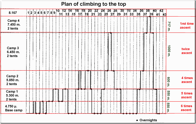
Description of distances and conditions per Camp
| From Base Camp 4.700 m. we move in a glacier. At its right, there is the danger of stone-fall. For this reason, any movement should be effected in the morning. A dangerous path of approx. 200 m. We still remain in the glacier, where there are only grevanches. So, we arrive at the 1rst camp after 4 hours. |
| 1rst camp: 5.300 m. to 2nd camp 5.850 m. Smooth gradient, need for 2 battons. Trekking for about 2 hours. |
| 2nd camp: 5.850 m. to 3rd camp 6.450 m. Bigger gradient. Trekking for 4,5-5,5 hours. |
| 3rd camp: 6.450 m. to 4rth camp 7.450 m. The hardest part, divided in its first 400 m (6.400-6.800) in snow or ice, the gradient being up to 45o The second part (6.800-7.100) is also divided in snow or ice, but the gradient is 55-60o and locally up to 70o. At 7.100 we cannot prepare our tents and we will have to move further for 350 m. more (7.100-7.450) Where we meet diffucult, mixed paths, we will prepare our 3 camps, where 2 characteristic huge rocks prevail. The plateau is not very large, but we can prepare 2 tents with no problem. Total duration: over 8 hours. |
| 4rth camp: 7.450 to the top 8.167 m. From the 4rth camp we move to the right, 40o, we avoid some rocks a little after and we then move to the left, 45o, till the start of the slope, at 7.900 m. There is here also a danger of snow layer unsticking, and the danger of one being swept away if one hasn't got the time to secure oneself. There are no stable ropes at this part of the track, as well as at the former one. From 7.900 m. we follow the slope to the right and after a while we arrive to the top. Total duration: approx. 8 hours. Return to the 4rth Camp after approx. 6 hours. |
© Copyright Oreivatein 1997-2017 - All rights reserved